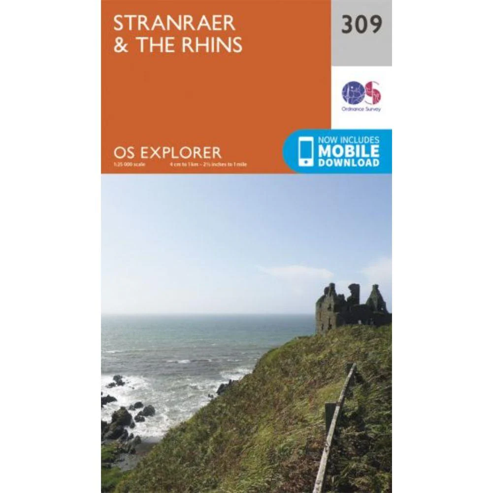
Ordnance Survey Explorer Map 309 - Stranraer & The Rhins
The Ordnance Survey Explorer Map 309 - Stranraer & The Rhins is the Ordnance Survey’s most detailed folding map and is recommended for anyone enjoying outdoor activities including walking, horse riding and off-road cycling. Providing complete GB coverage, the OS Explorer map series details information essential in the great outdoors, including youth hostels, pubs and visitor information. Rights of way, fences, permissive paths and bridleways are clearly shown, ensuring you have the best information to get the most out of your time in the countryside.
1:25 000 scale (4 cm to 1 km – 2.5 inches to 1 mile) The essential map for outdoor activities.
Ordnance Survey Explorer Map 309 - Stranraer & The Rhins Features:
- E2 (European Long Distance Route)
- Southern Upland Way (Long Distance Route)
- Strathclyde
- Dumfries & Galloway
- Stranraer
How to access the digital version of this map This map comes with a digital version which you can download to your smartphone or tablet.
Go to OS.uk/redeem for more details (terms and conditions apply).
Scratch off the panel on the inside cover of the map to reveal a code, you are then just three easy steps away from downloading your digital map.
Original: $14.93
-65%$14.93
$5.23Product Information
Product Information
Shipping & Returns
Shipping & Returns
Description
The Ordnance Survey Explorer Map 309 - Stranraer & The Rhins is the Ordnance Survey’s most detailed folding map and is recommended for anyone enjoying outdoor activities including walking, horse riding and off-road cycling. Providing complete GB coverage, the OS Explorer map series details information essential in the great outdoors, including youth hostels, pubs and visitor information. Rights of way, fences, permissive paths and bridleways are clearly shown, ensuring you have the best information to get the most out of your time in the countryside.
1:25 000 scale (4 cm to 1 km – 2.5 inches to 1 mile) The essential map for outdoor activities.
Ordnance Survey Explorer Map 309 - Stranraer & The Rhins Features:
- E2 (European Long Distance Route)
- Southern Upland Way (Long Distance Route)
- Strathclyde
- Dumfries & Galloway
- Stranraer
How to access the digital version of this map This map comes with a digital version which you can download to your smartphone or tablet.
Go to OS.uk/redeem for more details (terms and conditions apply).
Scratch off the panel on the inside cover of the map to reveal a code, you are then just three easy steps away from downloading your digital map.